
Request A Quote


Advanced Low-Altitude UAV Solutions
TopXGun eVTOL UAV platforms combine vertical takeoff flexibility with fixed-wing efficiency, enabling long-endurance, high-payload, and mission-ready performance across complex operational environments.
Designed for inspection, logistics, emergency response, and special mission applications, they deliver reliable and efficient aerial solutions for diverse industry needs.
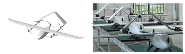
STAR-15 VTOL Fixed-Wing UAV
It features excellent flight performance, long endurance, high payload adaptability, and efficient operational capability.
It can flexibly integrate various payloads for mapping, inspection, and environmental monitoring, meeting data acquisition needs across different mission scenarios.
With stable and reliable performance and a high degree of customization, it provides efficient and accurate data acquisition solutions for multiple industries.
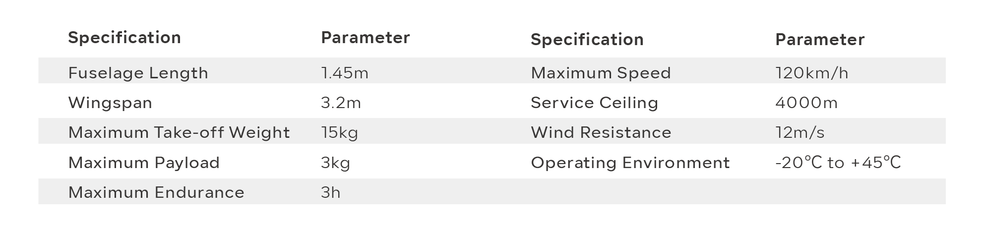




STAR-40E Tilt-Rotor Multirotor UAV
Featuring an innovative tilt-rotor design, the STAR-40E enables seamless transition between multirotor vertical takeoff and landing and fixed-wing long-endurance cruise flight.
Its intelligent eight-power-system configuration includes four inner rotors capable of 90° tilting, reducing dependence on takeoff and landing sites while combining the flexibility of multirotors with the efficiency of fixed-wing aircraft.
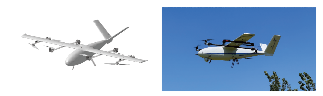
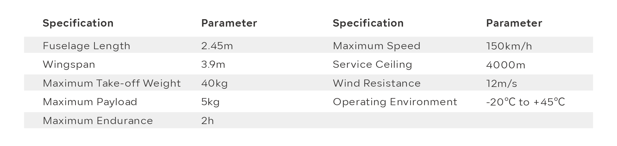




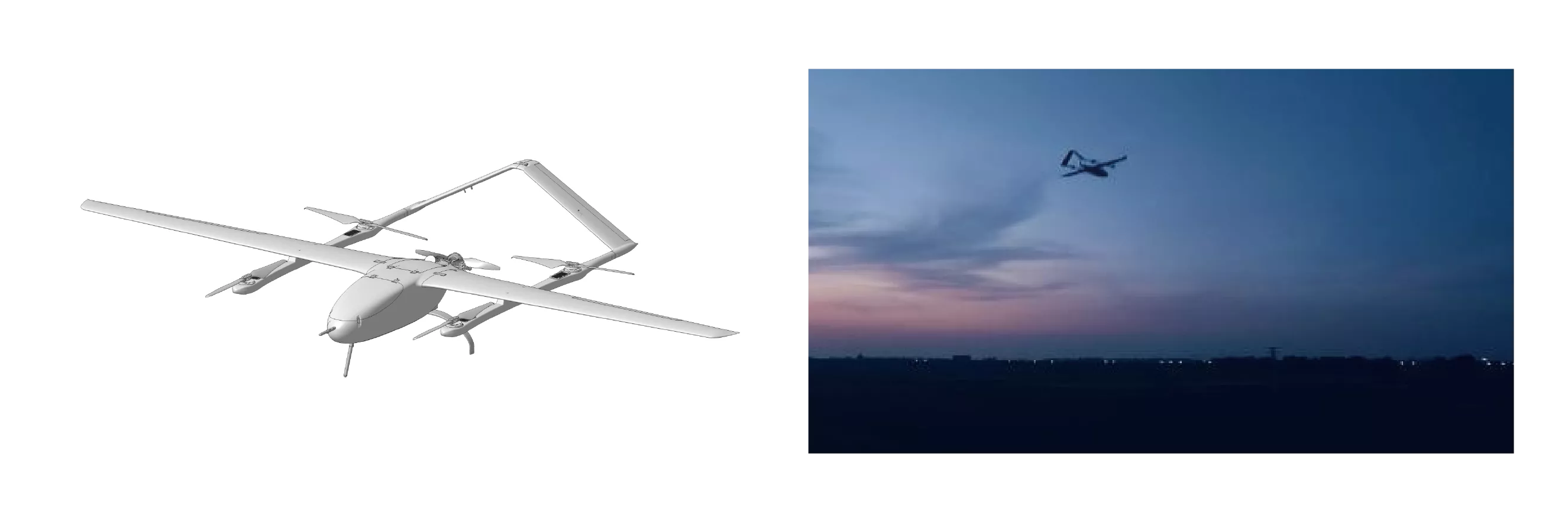
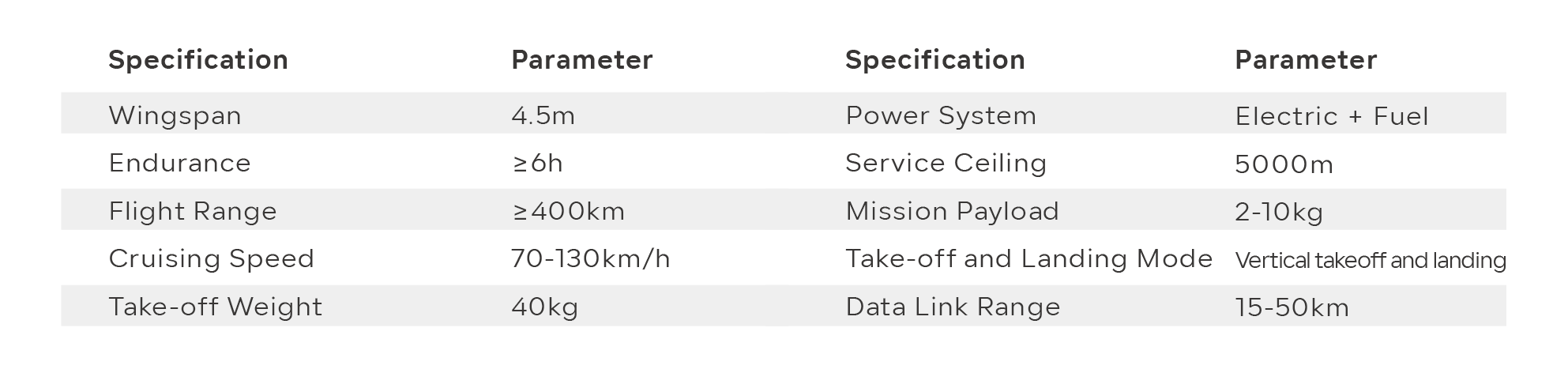
STAR-40F VTOL Fixed-Wing UAV
Designed for inspection and surveying, emergency response, aerial photography, and other operational scenarios, the STAR-40F is capable of performing missions in complex terrains such as mountains, hills, forests, and densely built urban areas.
Its flexible deployment capability significantly expands UAV application possibilities, making it an ideal choice for industrial-grade operations.




STAR-100F VTOL Fixed-Wing UAV
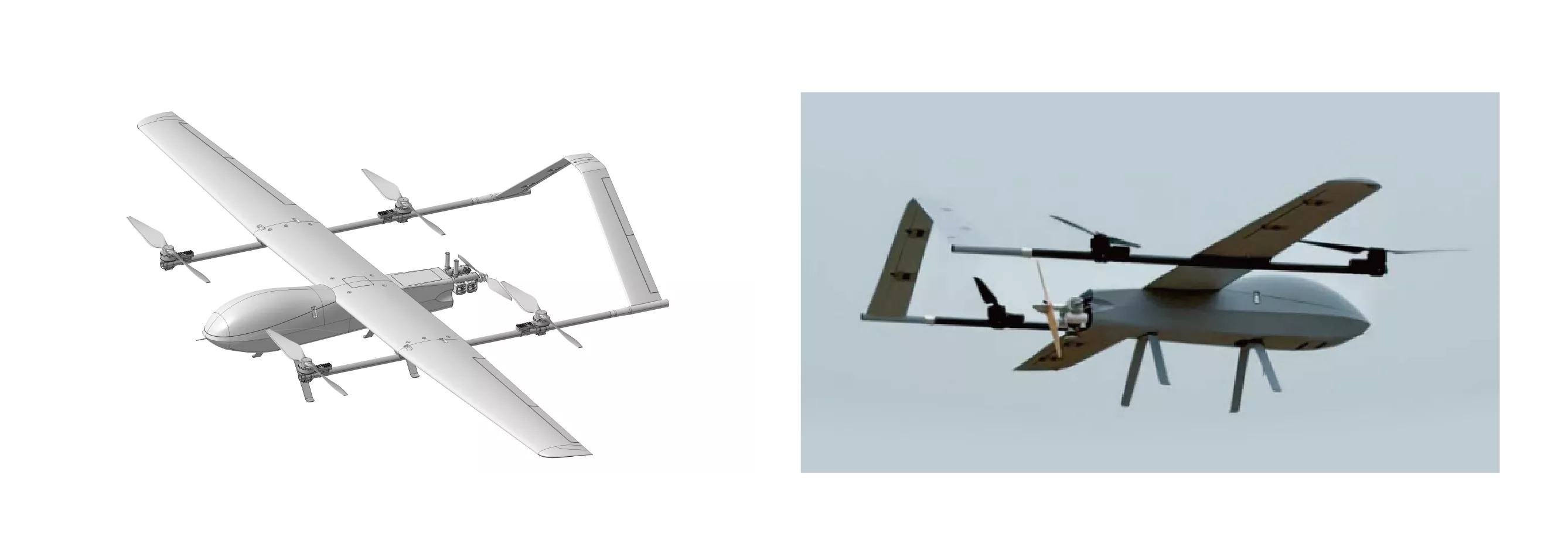
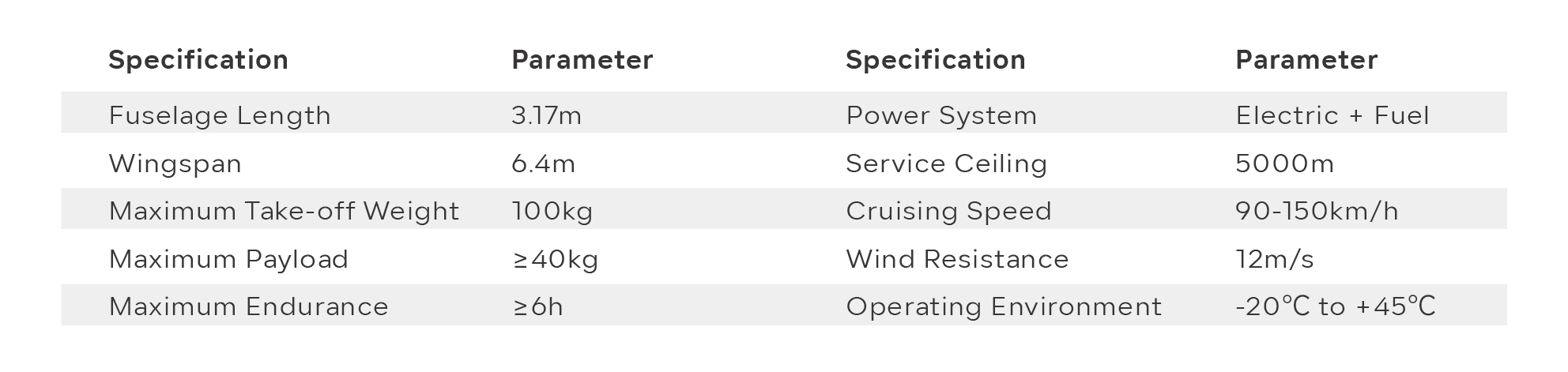
Featuring an innovative hybrid configuration that combines fixed-wing aircraft with rotor systems, the STAR-100F integrates the flexible vertical takeoff and landing capability of multirotors with the long-endurance advantages of fixed-wing platforms.
It supports a wide range of mission payloads, including airborne satellite communication equipment, EO/IR gimbals, oblique photography cameras, PDT base stations, and broadband mesh communication systems.
Designed for diverse operational scenarios, it is well suited for regional logistics, emergency communication, inspection, surveying, and mapping missions.




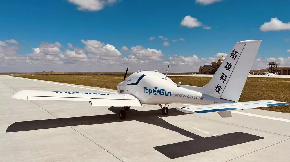
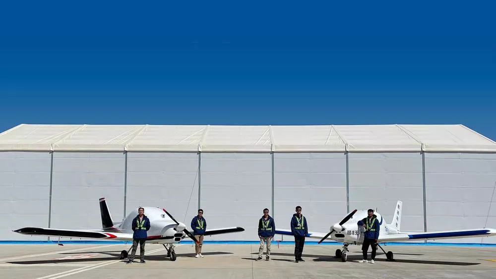
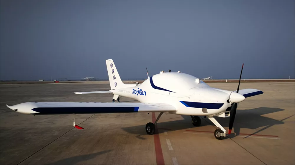
STAR-650 Large Fixed-Wing UAV
STAR-650 features high-altitude takeoff and landing capability with short takeoff and landing distance requirements. It can operate from general aviation runways, highways, and flat hardened dirt roads, offering strong environmental adaptability and cost-efficiency advantages.
Widely applied in remote sensing, aerial surveying, reconnaissance missions, material transport, border patrol, and emergency rescue operations.



Application Scenarios

Reconnaissance Applications
Capable of carrying high-zoom reconnaissance cameras or infrared imaging systems, enabling up to 10 hours of persistent aerial observation for continuous target monitoring.
Suitable for applications such as forest fire prevention, oil pipeline inspection, and other long-duration surveillance missions.

Surveying & Mapping Applications
Capable of carrying professional aerial survey cameras, oblique cameras, and LiDAR systems for precise geographic data acquisition.
Combined with efficient post-processing software, it enables high-accuracy 3D mapping with the advantages of long flight endurance and wide-area coverage.

Agriculture Monitoring
Equipped with multispectral cameras, the UAV enables high-resolution data collection over farmland and orchards, building comprehensive crop growth datasets.
Historical data can be accessed anytime for real-time monitoring of pests and diseases, supporting yield evaluation and data-driven smart agriculture management.

Logistics & Transportation
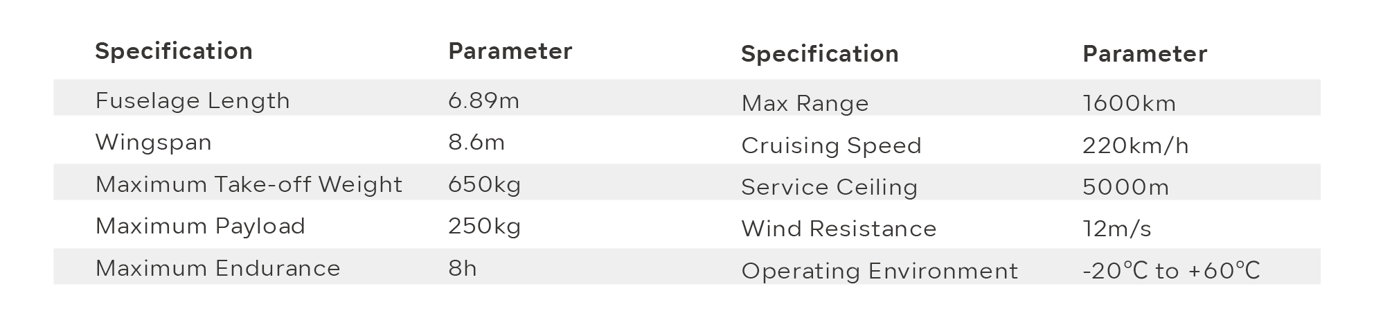
The large fixed-wing UAV has a maximum takeoff weight of 650 kg and a payload capacity of up to 200 kg, with a flight range of approximately 1,500 km.
It serves as an aerial logistics platform for fast cargo transportation, significantly improving operational efficiency.

Emergency Response
In the event of geological disasters or emergency situations, the UAV can deploy airborne communication relay systems to restore connectivity.
It can also deliver emergency supplies and carry imaging equipment for long-duration aerial surveillance and situational awareness.

Smart City Applications
Equipped with high-definition cameras and sensors, the UAV enables real-time monitoring of traffic flow, environmental conditions, and public safety.
It supports traffic optimization, pollution detection, infrastructure maintenance, and emergency decision-making, improving urban management efficiency through integrated air-ground operations.